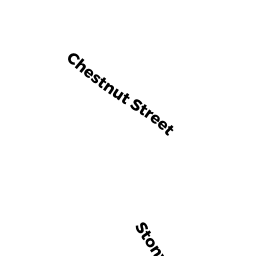
300 CHESTNUT ST
Owner Information
FILIPPI DARYL T
300 CHESTNUT ST
HUDSON, MA 01749


Property Details
300 CHESTNUT ST is classified as a Single Family Residential (Modern/contemp).
The primary structure on this property was built in 1998. There are 4,085ft2 of built area within this property. There is 2,349ft2 of residential/living space within this property. This property is listed as having 6 rooms.
300 CHESTNUT ST is valued at $512,600. The land is valued at $202,200 and the structures are valued at $310,400.
This property is in Zone SA5. Confirm with local Zoning Board authorities to ensure there are no overlays or other easements on this property.
The most recent deed for 300 CHESTNUT ST is recorded at the local registrar in Book 29814, Page 268. 300 CHESTNUT ST was last sold on Thursday, February 18, 1999 for $312,000.
Assessment data from fiscal year 2021.
Flood Data
This property is partially within the A Zone (within floodplain). Approximately 0.29 acres (20.78%) of the property is within this zone.
This information is sourced from the FEMA National Flood Hazard Layer. See our full disclamer.
Broadband Internet Providers
| Provider | Type | Bandwidth (mbps) | |
|---|---|---|---|
| GCI Communication Corp. | Satellite | 0 | 0 |
| Crown Castle Fiber | Fiber | 0 | 0 |
| Viasat Inc | Satellite | 100 | 3 |
| Verizon New England Inc. | Fiber | 940 | 880 |
| Comcast | Cable | 1000 | 35 |
| HughesNet | Satellite | 25 | 3 |
| VSAT Systems, LLC. | Satellite | 2 | 1 |
Broadband service provider data from December 2020.
Adjacent Properties
- CHESTNUT ST
Developable Residential Land owned by THE UNDERWOOD DALEY FAMILY TRUST - 324 CHESTNUT ST
Single Family Residential owned by GAMBLE LAURA L - 2 KELLY LN
Single Family Residential owned by OMALLEY SHAWN M - 308 CHESTNUT ST
Single Family Residential owned by WELTON JACOB A - 296 CHESTNUT ST
Single Family Residential owned by CHING WALTER S - KELLY LN
Undevelopable Residential Land owned by FILIPPI DARRYL - 4 KELLY LN
Single Family Residential owned by KEVIN C OMALLEY TRUSTEE